Project Background
Utilities – Powerline Projects with Pixelo
The project scope wanted to create the utility data base of the power line corridor data the for further up gradation, planning and development and maintenance. The scope of the project was to extract and classify the power line features from the Point cloud based on European standard National grid ET (Electrical Transmission System). These features were provided as vectors and classified point clouds for further use in GIS mapping workflows. The data provided by Pixelo in association with Client enabled the governments to take better decisions as they provided better insights as to where certain features are located on the power lines.
Pixelo provided engineering-ready data which could also be used for any future projects undertaken by the EB.
Project Scope
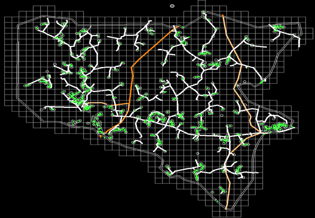
The case study includes the processing of transmission power line and distribution network along with danger vegetation identification and vegetation encroachment with expect to power lines.
General Information
The objective of the project is to prepare inputs for the vegetation clearance analysis of the power distribution network which includes
- Stringing conductors by voltage
- Identifying infringing vegetation within predefined radial and fall-in distances
- Identifying all man-made features from infringing vegetation
- Clean-up of road and ground classification
Inputs
- Tiled Point Cloud
- Ortho Imagery
- Template Workspace containing
– Pole locations (LV only)
– Centrelines (by KV)
– PTC file
– Topo Schema
– 2x TerraScan Macros - Clean-up of road and ground classification
- FME Topo checker workbench (FME)
Levels used in Wire stringing
| Name | Level Number |
|---|---|
| Default | 0 |
| 2KV | 1 |
| 2_7KV | 2 |
| 6_6KV | 3 |
| 11KV | 4 |
| 22KV | 5 |
| 33KV | 6 |
| 66KV | 7 |
| 132KV | 8 |
| LV | 9 |
| Shield wires | 10 |
| Block | 50 |
| 2KV_centrelines | 51 |
| 2_7KV_centrelines | 52 |
| 6_6KV_centrelines | 53 |
| 11KV_centrelines | 54 |
| 22KV_centrelines | 55 |
| 33KV_centrelines | 56 |
| 66KV_centrelines | 57 |
| 132KV_centrelines | 58 |
| LV_centrelines | 59 |
| LV_towers | 60 |
| Buffered_area | 100 |
| Area | 101 |
Classification classes
| Class Name | Class Code | Feature Description |
|---|---|---|
| Unclassified | 1 | Created – Not Classified |
| Ground | 2 | Ground within 100m of wires |
| Low Vegetation | 3 | Veg 0-0.5m |
| Main Vegetation | 4 | Veg above 2m not infringing |
| Danger Vegetation | 5 | Veg above 2m and infringing wires (radial or fall-in) |
| Building | 6 | Buildings within 50m |
| Low Point | 7 | Spurious points above or below ground |
| Medium Vegetation | 8 | Veg below 2m |
| Overlap | 12 | Overlap between flight strips |
| Wires | 14 | Strung Wires |
| Structures | 15 | Structures for strung wires |
| Man-made | 16 | Man-made objects |
| Roads | 17 | Roads |
| Motorway | 18 | Motorways |
| Not Needed Ground | 20 | Ground outside of 100m from wires |
| Not Needed Building | 21 | Buildings outside of 50m from wires |
| Not Needed Vegetation | 22 | Vegetation outside of 50m from wires |
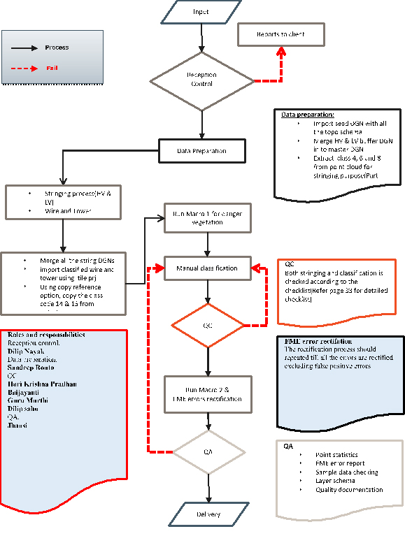
Workflow
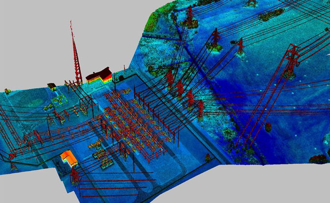
Classified Substation
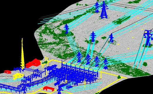
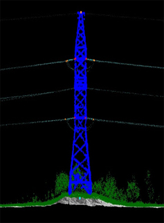
Classified Tower
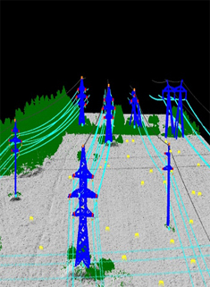
Classified Towers and Wires
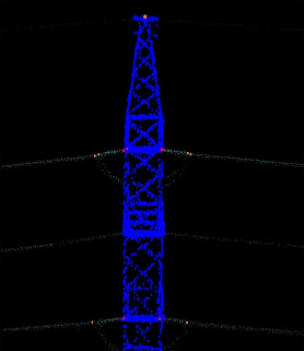
Tower Top & Bottom Points
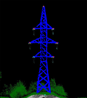
Conductor and Insulator Attachment Points
Deliverables
Wires are classified and vectorized based on the voltage along with classification of structures (Poles). The voltage can be identified based on the input centrelines.
Using the classified wires points and wire vectors, danger/canopy vegetation is determined and the classification is done to filter out all other classes from danger/canopy vegetation. This includes filtering out of building points, manmade objects, temporary features, etc. Also classification of roads is part of the project and the classification has to be done up to 5m from wires.
As a result of our consistent delivery of high quality output in record time, the relationship between Pixelo and Client has completed over 1 decade and continuing yet. The long partnership has witnessed successful completion of several projects in multiple cities in the European regions(covered almost 1.5 lakh LKM throughout the UK).
Final Output
- DGN containing strung conductors
- Classified Tiled Point Cloud
- Topo checker Error Report (FME error report)
- QC documentation